Compare A Price Logo
Brands
Categories
TabletsSmartwatchesFlame IconMobile PhonesGame ConsolesHeadphonesLaptopsEarpodsTelevisionsAir FryersWashing Machine
Compare A Price Logo

Compare A Price is a price comparison website that connects shoppers with trusted online retailers, making it easy to compare prices online across millions of products. From technology to home essentials, discover real-time price differences and explore over 3.8 million products & their listings in one place.

Discover Us

Up/down arrow for expanding footer items
  • Home
  • About Us
  • How It Works
  • Why Compare Prices
  • FAQs
  • Contact Us

Compare & Shop

Up/down arrow for expanding footer items
  • Save Money Online
  • Category Hub
  • Brands Directory
  • Stores We List

Trending Categories

Up/down arrow for expanding footer items
  • Air Conditioners
  • Air Coolers
  • Fans
  • Sunscreens
  • Sunglasses
  • Swimming Pools

Trending Brands

Up/down arrow for expanding footer items
  • Black & Decker
  • Pro Breeze
  • Dyson
  • Malibu
  • Ray-Ban
  • Bestway

Partner With Us

Up/down arrow for expanding footer items
  • Get Listed
  • Affiliate Partnerships
  • Retailer Benefits

Help & Legal

Up/down arrow for expanding footer items
  • Legal
  • Affiliate Disclosure
  • Privacy Policy
  • Cookie Policy
  • GDPR Compliance
  • Terms & Conditions

Contact Us

Media & Press

[email protected]

Get Listed

[email protected]

Subscribe

© Compare A Price. All Rights Reserved. Your ultimate destination for smarter shopping & unbeatable deals.

Product of syhtek software solutions. Designed & Developed by World Business Software Solutions

North Kintyre & Tarbert by Ordnance Survey (Sheet map, folded, 2016) UK Prices Comparison

Best price offer of £13.75 from verified retailer

  1. Home
  2. Compare Prices
  3. Maps
  4. Ordnance Survey
Image of North Kintyre & Tarbert by Ordnance Survey (Sheet map, folded, 2016)

Stores Price Range

£13.75 to £15.29

Starting from

£13.75

Product Details & Information

Compare prices of North Kintyre & Tarbert by Ordnance Survey (Sheet map, folded, 2016) across trusted retailers.

Image of North Kintyre & Tarbert by Ordnance Survey (Sheet map, folded, 2016)
Comparison SummaryProduct EAN / GTINFrequently Asked Questions

Price Comparison Summary

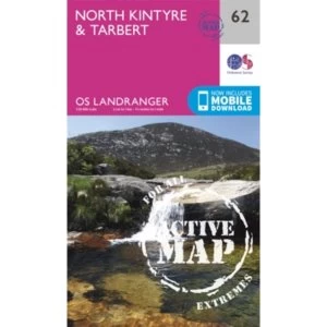
The best price for the North Kintyre & Tarbert by Ordnance Survey (Sheet map, folded, 2016) starts from £13.75, with listings currently reaching up to £15.29 across 2 verified retailers. Availability and pricing may vary depending on seller and condition.

We’ve identified 2 active listings available in New condition. This allows you to compare available options based on price, condition and seller.

Why compare prices on Compare A Price?

  • Compare prices from verified retailers in one place
  • View available listings across new, used and refurbished conditions
  • See transparent price differences to support informed buying decisions
  • Access real-time availability from retailers and marketplaces

Compare Prices
Across 3.8M+ Products

Search millions of products beyond Maps to compare prices instantly.

Compare Before You Buy

Compare North Kintyre & Tarbert by Ordnance Survey (Sheet map, folded, 2016) prices, retailer options and product listings before buying online.

Comparing prices for North Kintyre & Tarbert by Ordnance Survey (Sheet map, folded, 2016) can help shoppers spot differences between retailers, product listings and purchase options before checkout. Prices may vary depending on stock availability, seller pricing, delivery choices, product condition or marketplace listings.

Compare A Price helps bring North Kintyre & Tarbert by Ordnance Survey (Sheet map, folded, 2016) listings into one place, making it easier to review prices across different UK stores and shopping platforms. Some listings may include new, used or refurbished products, while others may vary by model version, included accessories or seller conditions. Comparing carefully before buying can help shoppers make more informed decisions online.

The same product can appear at different prices across retailers for many reasons, including promotions, stock changes and marketplace competition. Checking multiple listings for North Kintyre & Tarbert by Ordnance Survey (Sheet map, folded, 2016) helps shoppers compare available options without manually searching across numerous websites.

Why Prices Vary Between Retailers

Understand pricing differences and buying options for North Kintyre & Tarbert by Ordnance Survey (Sheet map, folded, 2016) before choosing the deal that suits you best.

When comparing prices for North Kintyre & Tarbert by Ordnance Survey (Sheet map, folded, 2016), it’s helpful to look beyond individual listings and understand how pricing can vary across the wider market. Differences in price may reflect factors such as product condition, retailer pricing strategies, stock availability or additional services like delivery and returns. By reviewing multiple offers together, shoppers can build a clearer picture of how North Kintyre & Tarbert by Ordnance Survey (Sheet map, folded, 2016) is positioned at any given time. This approach supports more confident decision-making, helping you recognise fair value and avoid relying on a single price point when assessing available options.

Comparing prices with confidence also means understanding what matters most to you as a buyer. Some shoppers prioritise lower upfront cost, while others may value retailer reputation, warranty coverage or convenience. Price comparison allows you to weigh these considerations side by side rather than focusing solely on headline pricing.

(4.0)
EAN:9780319473856

Maps By Ordnance Survey

Available Conditions:

We may earn a commission for qualifying purchases through affiliate links. Affiliate Disclosure

Marketplace Listings

We may earn a commission for qualifying purchases through affiliate links. Affiliate Disclosure

Logo of Amazon

Amazon

Visit Site
Logo of eBay

eBay

Visit Site

Compare UK Stores Prices

Showing all 2 offers

We may earn a commission for qualifying purchases through affiliate links. Affiliate Disclosure

Logo of Hive Books

Hive Books

£13.75
View Deal

Looking to compare Ordnance Survey Maps prices in the UK? Browse current offers and explore live listings from multiple sellers to find a deal that suits your budget.

Frequently Asked Questions

What prices are shown for North Kintyre & Tarbert by Ordnance Survey (Sheet map, folded, 2016) on this page?
This page shows verified retailer offers for North Kintyre & Tarbert by Ordnance Survey (Sheet map, folded, 2016). Verified retailer offers are the main price context on this page.
What does "verified retailer offer" mean?
Verified retailer offers are listings from retailers intended to match the product shown on this page. When available, they are treated as the main price context for North Kintyre & Tarbert by Ordnance Survey (Sheet map, folded, 2016) on Compare A Price.
What are "marketplace related listings" (Amazon/eBay)?
Marketplace related listings come from marketplaces such as Amazon and eBay. When shown, they are not verified exact matches and may include accessories, bundles, variants, refurbished/used items, or different conditions.
What's the lowest price shown for North Kintyre & Tarbert by Ordnance Survey (Sheet map, folded, 2016) on this page?
The lowest verified retailer price shown on this page for North Kintyre & Tarbert by Ordnance Survey (Sheet map, folded, 2016) is £13.75. Click through to the retailer to confirm delivery costs, stock status, and final total.
How many offers are shown for North Kintyre & Tarbert by Ordnance Survey (Sheet map, folded, 2016)?
This page shows 2 verified retailer listings across 2 retailers.
Where do the marketplace listings come from?
When marketplace related listings are shown, they can come from Amazon and/or eBay.
Which price should I use as the main product price?
Use verified retailer prices on this page as the main price context for North Kintyre & Tarbert by Ordnance Survey (Sheet map, folded, 2016). Marketplace prices are shown separately as related listings and are not verified exact matches.
Why can marketplace prices look much lower than retailer prices?
When marketplace related listings appear, they may refer to accessories, bundles, older revisions, refurbished/used units, or different variants, so they are shown separately from verified retailer offers.
Does the listed price include delivery and fees?
Not always. Some sellers include delivery in the listed price, while others add fees at checkout. Click through from the listing on this page to confirm delivery costs, fees, and the final total.
Is North Kintyre & Tarbert by Ordnance Survey (Sheet map, folded, 2016) in stock?
Listings can change. Click through from an offer shown on this page to confirm current stock and delivery times on the seller's site.
How often is this page updated?
We update listings using data provided by retailers and marketplaces, and update timing can vary by source. This page reflects the most recent listing data we've received for the offers currently shown here.
Where can I browse alternatives to North Kintyre & Tarbert by Ordnance Survey (Sheet map, folded, 2016)?
Browse more items in Maps to compare similar alternatives by price and availability.
Where can I buy North Kintyre & Tarbert by Ordnance Survey (Sheet map, folded, 2016) in the UK?
You can buy North Kintyre & Tarbert by Ordnance Survey (Sheet map, folded, 2016) from the verified retailer offers shown on this page, starting from £13.75. Open an offer to check delivery, returns and final total on the retailer’s site.
What’s the best price for North Kintyre & Tarbert by Ordnance Survey (Sheet map, folded, 2016)?
The lowest verified retailer price shown on this page for North Kintyre & Tarbert by Ordnance Survey (Sheet map, folded, 2016) is £13.75. This reflects the verified retailer offers currently displayed here. Open the offer to confirm delivery costs, stock status and final total on the retailer’s site.

EANs & GTINs

  1. 9780319473856

Disclaimer: While we aim to keep product data accurate and up to date, EANs and GTINs are provided for informational purposes only. We recommend verifying product identifiers directly on the manufacturer's or retailer's website before purchasing.

Compare Prices

Explore Listings

Shop Smarter

Whether searching for everyday essentials, technology products, appliances, gaming accessories or lifestyle purchases, comparing prices before buying can help shoppers understand available options more clearly. Compare A Price supports product discovery by helping users review retailer listings, compare pricing differences and explore purchase choices for North Kintyre & Tarbert by Ordnance Survey (Sheet map, folded, 2016) in one simpler shopping journey.

Confident Comparison

Compare prices for North Kintyre & Tarbert by Ordnance Survey (Sheet map, folded, 2016) across sellers to understand value, availability and buying options clearly.

Clear Market View

See how North Kintyre & Tarbert by Ordnance Survey (Sheet map, folded, 2016) prices vary across the market to assess fair value confidently.

Smarter Decisions

Use price comparison insights for North Kintyre & Tarbert by Ordnance Survey (Sheet map, folded, 2016) to choose offers matching your budget and preferences.

01
New In Stock

EAN: 09780319473856

North Kintyre & Tarbert Sheet map, folded
£13.75View Deal
Logo of Love Reading

Love Reading

£15.29
View Deal
01
New In Stock

EAN: 09780319473856

North Kintyre & Tarbert Books
£15.29View Deal

Related Ordnance Survey Maps Products

Compare similar products related to North Kintyre & Tarbert by Ordnance Survey (Sheet map, folded, 2016) to explore alternative options.

Similar Choice

Image of Yorkshire Dales South & Western by Ordnance Survey (Sheet map, folded, 2016)

Yorkshire Dales South & Western by Ordnance Survey (Sheet map, folded, 2016)

Starting From

£11.19

3 Stores

Similar Choice

Image of Yorkshire Dales Northern & Central by Ordnance Survey (Sheet map, folded, 2016)

Yorkshire Dales Northern & Central by Ordnance Survey (Sheet map, folded, 2016)

Starting From

£11.19

3 Stores

Similar Choice

Image of Yeovil and Sherbourne:129 by Ordnance Survey (Sheet map, folded, 2015)

Yeovil and Sherbourne:129 by Ordnance Survey (Sheet map, folded, 2015)

Starting From

£13.55

2 Stores

Similar Choice

Image of Woodbridge and Saxmundham by Ordnance Survey (Sheet map, folded, 2015)

Woodbridge and Saxmundham by Ordnance Survey (Sheet map, folded, 2015)

Starting From

£11.19

2 Stores

Similar Choice

Image of Wolverhampton and Dudley, Stourbridge and Kidderminster by Ordnance Survey (Sheet map, folded, 2015)

Wolverhampton and Dudley, Stourbridge and Kidderminster by Ordnance Survey (Sheet map, folded, 2015)

Starting From

£11.65

2 Stores

Similar Choice

Image of Withernsea and Spurn Head by Ordnance Survey (Sheet map, folded, 2015)

Withernsea and Spurn Head by Ordnance Survey (Sheet map, folded, 2015)

Starting From

£13.75

2 Stores

Similar Choice

Image of Winchester, New Alresford & East Meon by Ordnance Survey (Sheet map, folded, 2015)

Winchester, New Alresford & East Meon by Ordnance Survey (Sheet map, folded, 2015)

Starting From

£13.55

2 Stores

Similar Choice

Image of Whitby, Esk Dale & Robin Hood's Bay by Ordnance Survey (Sheet map, folded, 2016)

Whitby, Esk Dale & Robin Hood's Bay by Ordnance Survey (Sheet map, folded, 2016)

Starting From

£11.19

2 Stores

Similar Choice

Image of Weston-Super-Mare and Bleadon Hill by Ordnance Survey (Sheet map, folded, 2015)

Weston-Super-Mare and Bleadon Hill by Ordnance Survey (Sheet map, folded, 2015)

Starting From

£13.55

2 Stores

Similar Choice

Image of West Lewis/Taobh Siar Leodhais by Ordnance Survey (Sheet map, folded, 2015)

West Lewis/Taobh Siar Leodhais by Ordnance Survey (Sheet map, folded, 2015)

Starting From

£13.55

2 Stores

Similar Choice

Image of Warminster and Trowbridge by Ordnance Survey (Sheet map/active map, folded, 2015)

Warminster and Trowbridge by Ordnance Survey (Sheet map/active map, folded, 2015)

Starting From

£13.55

2 Stores

Similar Choice

Image of Warminster and Trowbridge by Ordnance Survey (Sheet map, folded, 2015)

Warminster and Trowbridge by Ordnance Survey (Sheet map, folded, 2015)

Starting From

£11.19

2 Stores

Similar Choice

Image of Wales & West Midlands by Ordnance Survey (Sheet map, folded, 2016)

Wales & West Midlands by Ordnance Survey (Sheet map, folded, 2016)

Listing From

£37.50

2 Marketplaces

Similar Choice

Image of Vale of Glamorgan, Rhondda & Porthcawl by Ordnance Survey (Sheet map, folded, 2016)

Vale of Glamorgan, Rhondda & Porthcawl by Ordnance Survey (Sheet map, folded, 2016)

Starting From

£11.19

2 Stores

Similar Choice

Image of Upper Clyde Valley, Biggar & Lanark by Ordnance Survey (Sheet map, folded, 2016)

Upper Clyde Valley, Biggar & Lanark by Ordnance Survey (Sheet map, folded, 2016)

Starting From

£11.19

2 Stores

Similar Choice

Image of Truro & Falmouth, Roseland Peninsula by Ordnance Survey (Sheet map, folded, 2016)

Truro & Falmouth, Roseland Peninsula by Ordnance Survey (Sheet map, folded, 2016)

AmazoneBay

2 Marketplaces

Similar Choice

Image of Torquay & Dawlish, Newton Abbot by Ordnance Survey (Sheet map, folded, 2015)

Torquay & Dawlish, Newton Abbot by Ordnance Survey (Sheet map, folded, 2015)

Starting From

£11.19

2 Stores

Similar Choice

Image of Thurso and John O'Groats by Ordnance Survey (Sheet map, folded, 2015)

Thurso and John O'Groats by Ordnance Survey (Sheet map, folded, 2015)

Starting From

£11.19

2 Stores

Similar Choice

Image of Thurso & Wick, John O'Groats by Ordnance Survey (Sheet map, folded, 2016)

Thurso & Wick, John O'Groats by Ordnance Survey (Sheet map, folded, 2016)

AmazoneBay

2 Marketplaces

Similar Choice

Image of Thurso & Dunbeath by Ordnance Survey (Sheet map, folded, 2016)

Thurso & Dunbeath by Ordnance Survey (Sheet map, folded, 2016)

Starting From

£11.19

3 Stores

Similar Choice

Image of Thornbury, Dursley and Yate by Ordnance Survey (Sheet map, folded, 2015)

Thornbury, Dursley and Yate by Ordnance Survey (Sheet map, folded, 2015)

Starting From

£11.65

2 Stores

Similar Choice

Image of Thetford Forest in the Brecks by Ordnance Survey (Sheet map, folded, 2015)

Thetford Forest in the Brecks by Ordnance Survey (Sheet map, folded, 2015)

Starting From

£13.75

2 Stores

Similar Choice

Image of Thetford & Diss, Breckland & Wymondham by Ordnance Survey (Sheet map, folded, 2016)

Thetford & Diss, Breckland & Wymondham by Ordnance Survey (Sheet map, folded, 2016)

Starting From

£13.55

2 Stores

Similar Choice

Image of The Cheviot Hills, Jedburgh & Wooler by Ordnance Survey (Sheet map, folded, 2015)

The Cheviot Hills, Jedburgh & Wooler by Ordnance Survey (Sheet map, folded, 2015)

Starting From

£13.55

2 Stores

Similar Choice

Image of Thames Estuary, Rochester & Southend-on-Sea by Ordnance Survey (Sheet map, folded, 2016)

Thames Estuary, Rochester & Southend-on-Sea by Ordnance Survey (Sheet map, folded, 2016)

Starting From

£13.55

2 Stores

Similar Choice

Image of Tenby & Pembroke by Ordnance Survey (Sheet map, folded, 2016)

Tenby & Pembroke by Ordnance Survey (Sheet map, folded, 2016)

Starting From

£13.55

2 Stores

Similar Choice

Image of Telford, Ironbridge and the Wrekin by Ordnance Survey (Sheet map, folded, 2015)

Telford, Ironbridge and the Wrekin by Ordnance Survey (Sheet map, folded, 2015)

Starting From

£11.65

2 Stores

Similar Choice

Image of Swansea, Neath and Port Talbot by Ordnance Survey (Sheet map, folded, 2015)

Swansea, Neath and Port Talbot by Ordnance Survey (Sheet map, folded, 2015)

Starting From

£11.19

2 Stores

Similar Choice

Image of Stroud, Tetbury and Malmesbury by Ordnance Survey (Sheet map, folded, 2015)

Stroud, Tetbury and Malmesbury by Ordnance Survey (Sheet map, folded, 2015)

Starting From

£11.19

2 Stores

Similar Choice

Image of Strathnaver, Bettyhill & Tongue by Ordnance Survey (Sheet map, folded, 2016)

Strathnaver, Bettyhill & Tongue by Ordnance Survey (Sheet map, folded, 2016)

Starting From

£11.19

3 Stores

Similar Choice

Image of Strathdon & Alford by Ordnance Survey (Sheet map, folded, 2016)

Strathdon & Alford by Ordnance Survey (Sheet map, folded, 2016)

Starting From

£11.85

3 Stores

Similar Choice

Image of Strath Halladale and Strathy Point by Ordnance Survey (Sheet map, folded, 2015)

Strath Halladale and Strathy Point by Ordnance Survey (Sheet map, folded, 2015)

Starting From

£11.19

2 Stores

Similar Choice

Image of Stratford-Upon-Avon and Evesham by Ordnance Survey (Sheet map, folded, 2015)

Stratford-Upon-Avon and Evesham by Ordnance Survey (Sheet map, folded, 2015)

Starting From

£11.19

2 Stores

Similar Choice

Image of Stranraer & Glenluce by Ordnance Survey (Sheet map, folded, 2016)

Stranraer & Glenluce by Ordnance Survey (Sheet map, folded, 2016)

Starting From

£11.19

2 Stores

Similar Choice

Image of Stoke-On-Trent and Newcastle Under Lyme by Ordnance Survey (Sheet map, folded, 2015)

Stoke-On-Trent and Newcastle Under Lyme by Ordnance Survey (Sheet map, folded, 2015)

Starting From

£11.19

3 Stores

Similar Choice

Image of Stirling and Ochil Hills West by Ordnance Survey (Sheet map, folded, 2015)

Stirling and Ochil Hills West by Ordnance Survey (Sheet map, folded, 2015)

Starting From

£13.55

2 Stores

Similar Choice

Image of Stirling & the Trossachs by Ordnance Survey (Sheet map, folded, 2016)

Stirling & the Trossachs by Ordnance Survey (Sheet map, folded, 2016)

Starting From

£13.55

2 Stores

Similar Choice

Image of Stafford & Telford, Ironbridge by Ordnance Survey (Sheet map, folded, 2016)

Stafford & Telford, Ironbridge by Ordnance Survey (Sheet map, folded, 2016)

Starting From

£11.19

2 Stores

Similar Choice

Image of St.Austell, Liskeard, Fowey, Looe and Lostwithiel by Ordnance Survey (Sheet map, folded, 2015)

St.Austell, Liskeard, Fowey, Looe and Lostwithiel by Ordnance Survey (Sheet map, folded, 2015)

Starting From

£11.19

2 Stores

Similar Choice

Image of St Davids & Haverfordwest:157 by Ordnance Survey (Sheet map, folded, 2016)

St Davids & Haverfordwest:157 by Ordnance Survey (Sheet map, folded, 2016)

Starting From

£11.19

3 Stores

Compare Popular Maps

Discover popular Maps and compare prices from trusted sellers to find the right deal.

Image of North Downs Way (Trailblazer British Walking Guides) : Practical walking guide to North Downs Way with 80 Large-Scale Walking Maps & Guides to 45 Town

North Downs Way (Trailblazer British Walking Guides) : Practical walking guide to North Downs Way with 80 Large-Scale Walking Maps & Guides to 45 Town

AmazoneBay
Compare

Popular Maps Brands

Compare Maps products from well known brands available across retailers.

Books Logo
Maps Logo
Ordnance Survey Logo
Michelin Logo

Popular Ordnance Survey Categories

Compare popular Ordnance Survey categories to find the best products and deals

Maps Logo
Maps
Lamps Logo
Lamps
Bedsheets Logo
Bedsheets

Explore More Ordnance Survey Products

Browse and compare other popular Ordnance Survey products to find the right option for you.

Image of Yorkshire Dales South & Western by Ordnance Survey (Sheet map, folded, 2016)

Yorkshire Dales South & Western by Ordnance Survey (Sheet map, folded, 2016)

Starting From

£11.19

Compare
Compare
Image of Yorkshire Dales South & Western by Ordnance Survey (Sheet map, folded, 2016)

Yorkshire Dales South & Western by Ordnance Survey (Sheet map, folded, 2016)

Starting From

£11.19

Compare
Image of Yorkshire Dales Northern & Central by Ordnance Survey (Sheet map, folded, 2016)

Yorkshire Dales Northern & Central by Ordnance Survey (Sheet map, folded, 2016)

Starting From

£11.19

Compare
Image of Yeovil and Sherbourne:129 by Ordnance Survey (Sheet map, folded, 2015)

Yeovil and Sherbourne:129 by Ordnance Survey (Sheet map, folded, 2015)

Starting From

£13.55

Compare
Image of Yeovil and Sherbourne by Ordnance Survey (Sheet map, folded, 2015)

Yeovil and Sherbourne by Ordnance Survey (Sheet map, folded, 2015)

Starting From

£11.19

Compare
Image of Writing London Sheet map, folded 2015

Writing London Sheet map, folded 2015

AmazoneBay
Compare
Image of World political laminated 2018 Sheet map, rolled

World political laminated 2018 Sheet map, rolled

Starting From

£28.55

Compare
Image of World Map

World Map

Listing From

£6.64

Compare
Image of Woodbridge and Saxmundham by Ordnance Survey (Sheet map, folded, 2015)

Woodbridge and Saxmundham by Ordnance Survey (Sheet map, folded, 2015)

Starting From

£11.19

Compare
Image of Wolverhampton and Dudley, Stourbridge and Kidderminster by Ordnance Survey (Sheet map, folded, 2015)

Wolverhampton and Dudley, Stourbridge and Kidderminster by Ordnance Survey (Sheet map, folded, 2015)

Starting From

£11.65

Compare
Image of Withernsea and Spurn Head by Ordnance Survey (Sheet map, folded, 2015)

Withernsea and Spurn Head by Ordnance Survey (Sheet map, folded, 2015)

Starting From

£13.75

Compare
Image of Winchester, New Alresford & East Meon by Ordnance Survey (Sheet map, folded, 2015)

Winchester, New Alresford & East Meon by Ordnance Survey (Sheet map, folded, 2015)

Starting From

£13.55

Compare
Image of Wild London Sheet map, folded 2016

Wild London Sheet map, folded 2016

Starting From

£3.60

Compare
Image of Whitby, Esk Dale & Robin Hood's Bay by Ordnance Survey (Sheet map, folded, 2016)

Whitby, Esk Dale & Robin Hood's Bay by Ordnance Survey (Sheet map, folded, 2016)

Starting From

£11.19

Compare
Image of Weston-Super-Mare, Bridgwater & Wells by Ordnance Survey (Sheet map, folded, 2016)

Weston-Super-Mare, Bridgwater & Wells by Ordnance Survey (Sheet map, folded, 2016)

Starting From

£11.19

Compare
Image of Weston-Super-Mare and Bleadon Hill by Ordnance Survey (Sheet map, folded, 2015)

Weston-Super-Mare and Bleadon Hill by Ordnance Survey (Sheet map, folded, 2015)

Starting From

£13.55

Compare
Image of West Lewis/Taobh Siar Leodhais by Ordnance Survey (Sheet map, folded, 2015)

West Lewis/Taobh Siar Leodhais by Ordnance Survey (Sheet map, folded, 2015)

Starting From

£13.55

Compare
Image of West Highland Way XT40 2008 Sheet map, folded

West Highland Way XT40 2008 Sheet map, folded

Starting From

£13.95

Compare
Image of West Highland Way (Trailblazer British Walking Guides) : 53 large-scale maps & guides to 26 towns and villages; Planning, Places to Stay, Places to Ea

West Highland Way (Trailblazer British Walking Guides) : 53 large-scale maps & guides to 26 towns and villages; Planning, Places to Stay, Places to Ea

AmazoneBay
Compare
Image of Wensleydale & Upper Wharfedale Sheet map, folded 2016

Wensleydale & Upper Wharfedale Sheet map, folded 2016

Starting From

£13.55

Compare
Image of Washington DC PopOut Map Sheet map, folded 2018

Washington DC PopOut Map Sheet map, folded 2018

AmazoneBay
Compare
Image of Warminster and Trowbridge by Ordnance Survey (Sheet map/active map, folded, 2015)

Warminster and Trowbridge by Ordnance Survey (Sheet map/active map, folded, 2015)

Starting From

£13.55

Compare
Image of Warminster and Trowbridge by Ordnance Survey (Sheet map, folded, 2015)

Warminster and Trowbridge by Ordnance Survey (Sheet map, folded, 2015)

Starting From

£11.19

Compare
Image of Wales & West Midlands by Ordnance Survey (Sheet map, folded, 2016)

Wales & West Midlands by Ordnance Survey (Sheet map, folded, 2016)

Listing From

£37.50

Compare
Image of Venice - Michelin City Map 9206 Laminated City Plan Sheet map 2016

Venice - Michelin City Map 9206 Laminated City Plan Sheet map 2016

AmazoneBay
Compare
Image of Veneto / Friuli Venice / Giulia 4 Sheet map, folded 2016

Veneto / Friuli Venice / Giulia 4 Sheet map, folded 2016

AmazoneBay
Compare
Image of Vale of Glamorgan, Rhondda & Porthcawl by Ordnance Survey (Sheet map, folded, 2016)

Vale of Glamorgan, Rhondda & Porthcawl by Ordnance Survey (Sheet map, folded, 2016)

Starting From

£11.19

Compare
Image of USA West Marco Polo Map by Marco Polo (Sheet map, folded, 2011)

USA West Marco Polo Map by Marco Polo (Sheet map, folded, 2011)

AmazoneBay
Compare
Image of USA - Michelin National Map 761 Map Sheet map 2012

USA - Michelin National Map 761 Map Sheet map 2012

AmazoneBay
Compare
Image of Upper Clyde Valley, Biggar & Lanark by Ordnance Survey (Sheet map, folded, 2016)

Upper Clyde Valley, Biggar & Lanark by Ordnance Survey (Sheet map, folded, 2016)

Starting From

£11.19

Compare
Image of Umbria and the Marches Marco Polo Map Sheet map, folded 2012

Umbria and the Marches Marco Polo Map Sheet map, folded 2012

AmazoneBay
Compare
Image of Tuscany Marco Polo Map Sheet map, folded 2011

Tuscany Marco Polo Map Sheet map, folded 2011

AmazoneBay
Compare
Image of Tuscany Marco Polo Holiday Map by Marco Polo (Sheet map, folded, 2013)

Tuscany Marco Polo Holiday Map by Marco Polo (Sheet map, folded, 2013)

AmazoneBay
Compare
Image of Truro & Falmouth, Roseland Peninsula by Ordnance Survey (Sheet map, folded, 2016)

Truro & Falmouth, Roseland Peninsula by Ordnance Survey (Sheet map, folded, 2016)

AmazoneBay
Compare
Image of Trailblazer Pennine Way

Trailblazer Pennine Way

Starting From

£11.65

Compare
Image of Trailblazer Dales Way

Trailblazer Dales Way

Starting From

£10.23

Compare
Origin Murals Logo
Generic Logo
NGK Logo
Jigsaw Puzzle Logo
Cambridge Logo
Celestron Logo
Collins Debden Logo
Costa Logo
Nikon Logo
Dorling Kindersley Logo
Dublin Logo
Sports Merchandise Logo
DC Comics Logo
Oxford Logo
Play & Go Logo
Board Games Logo
Books Logo
Books
Image of Yorkshire Dales Northern & Central by Ordnance Survey (Sheet map, folded, 2016)

Yorkshire Dales Northern & Central by Ordnance Survey (Sheet map, folded, 2016)

Starting From

£11.19

Compare
Compare
Image of Yeovil and Sherbourne:129 by Ordnance Survey (Sheet map, folded, 2015)

Yeovil and Sherbourne:129 by Ordnance Survey (Sheet map, folded, 2015)

Starting From

£13.55

Compare
Compare
Image of Woodbridge and Saxmundham by Ordnance Survey (Sheet map, folded, 2015)

Woodbridge and Saxmundham by Ordnance Survey (Sheet map, folded, 2015)

Starting From

£11.19

Compare
Compare
Image of Wolverhampton and Dudley, Stourbridge and Kidderminster by Ordnance Survey (Sheet map, folded, 2015)

Wolverhampton and Dudley, Stourbridge and Kidderminster by Ordnance Survey (Sheet map, folded, 2015)

Starting From

£11.65

Compare
Compare
Image of Withernsea and Spurn Head by Ordnance Survey (Sheet map, folded, 2015)

Withernsea and Spurn Head by Ordnance Survey (Sheet map, folded, 2015)

Starting From

£13.75

Compare
Compare
Image of Winchester, New Alresford & East Meon by Ordnance Survey (Sheet map, folded, 2015)

Winchester, New Alresford & East Meon by Ordnance Survey (Sheet map, folded, 2015)

Starting From

£13.55

Compare
Compare
Image of Whitby, Esk Dale & Robin Hood's Bay by Ordnance Survey (Sheet map, folded, 2016)

Whitby, Esk Dale & Robin Hood's Bay by Ordnance Survey (Sheet map, folded, 2016)

Starting From

£11.19

Compare
Compare
Image of Weston-Super-Mare and Bleadon Hill by Ordnance Survey (Sheet map, folded, 2015)

Weston-Super-Mare and Bleadon Hill by Ordnance Survey (Sheet map, folded, 2015)

Starting From

£13.55

Compare
Compare
Image of West Lewis/Taobh Siar Leodhais by Ordnance Survey (Sheet map, folded, 2015)

West Lewis/Taobh Siar Leodhais by Ordnance Survey (Sheet map, folded, 2015)

Starting From

£13.55

Compare
Compare
Image of Warminster and Trowbridge by Ordnance Survey (Sheet map/active map, folded, 2015)

Warminster and Trowbridge by Ordnance Survey (Sheet map/active map, folded, 2015)

Starting From

£13.55

Compare
Compare
Image of Warminster and Trowbridge by Ordnance Survey (Sheet map, folded, 2015)

Warminster and Trowbridge by Ordnance Survey (Sheet map, folded, 2015)

Starting From

£11.19

Compare
Compare
Image of Wales & West Midlands by Ordnance Survey (Sheet map, folded, 2016)

Wales & West Midlands by Ordnance Survey (Sheet map, folded, 2016)

Listing From

£37.50

Compare
Compare
Image of Vale of Glamorgan, Rhondda & Porthcawl by Ordnance Survey (Sheet map, folded, 2016)

Vale of Glamorgan, Rhondda & Porthcawl by Ordnance Survey (Sheet map, folded, 2016)

Starting From

£11.19

Compare
Compare
Image of Upper Clyde Valley, Biggar & Lanark by Ordnance Survey (Sheet map, folded, 2016)

Upper Clyde Valley, Biggar & Lanark by Ordnance Survey (Sheet map, folded, 2016)

Starting From

£11.19

Compare
Compare
Image of Truro & Falmouth, Roseland Peninsula by Ordnance Survey (Sheet map, folded, 2016)

Truro & Falmouth, Roseland Peninsula by Ordnance Survey (Sheet map, folded, 2016)

AmazoneBay
Compare
Compare
Image of Torquay & Dawlish, Newton Abbot by Ordnance Survey (Sheet map, folded, 2015)

Torquay & Dawlish, Newton Abbot by Ordnance Survey (Sheet map, folded, 2015)

Starting From

£11.19

Compare
Compare
Image of Thurso and John O'Groats by Ordnance Survey (Sheet map, folded, 2015)

Thurso and John O'Groats by Ordnance Survey (Sheet map, folded, 2015)

Starting From

£11.19

Compare
Compare
Image of Thurso & Wick, John O'Groats by Ordnance Survey (Sheet map, folded, 2016)

Thurso & Wick, John O'Groats by Ordnance Survey (Sheet map, folded, 2016)

AmazoneBay
Compare
Compare
Image of Thurso & Dunbeath by Ordnance Survey (Sheet map, folded, 2016)

Thurso & Dunbeath by Ordnance Survey (Sheet map, folded, 2016)

Starting From

£11.19

Compare
Compare
Image of Thornbury, Dursley and Yate by Ordnance Survey (Sheet map, folded, 2015)

Thornbury, Dursley and Yate by Ordnance Survey (Sheet map, folded, 2015)

Starting From

£11.65

Compare
Compare
Image of Thetford Forest in the Brecks by Ordnance Survey (Sheet map, folded, 2015)

Thetford Forest in the Brecks by Ordnance Survey (Sheet map, folded, 2015)

Starting From

£13.75

Compare
Compare
Image of Thetford & Diss, Breckland & Wymondham by Ordnance Survey (Sheet map, folded, 2016)

Thetford & Diss, Breckland & Wymondham by Ordnance Survey (Sheet map, folded, 2016)

Starting From

£13.55

Compare
Compare
Image of The Cheviot Hills, Jedburgh & Wooler by Ordnance Survey (Sheet map, folded, 2015)

The Cheviot Hills, Jedburgh & Wooler by Ordnance Survey (Sheet map, folded, 2015)

Starting From

£13.55

Compare
Compare
Image of Thames Estuary, Rochester & Southend-on-Sea by Ordnance Survey (Sheet map, folded, 2016)

Thames Estuary, Rochester & Southend-on-Sea by Ordnance Survey (Sheet map, folded, 2016)

Starting From

£13.55

Compare
Compare
Image of Tenby & Pembroke by Ordnance Survey (Sheet map, folded, 2016)

Tenby & Pembroke by Ordnance Survey (Sheet map, folded, 2016)

Starting From

£13.55

Compare
Compare
Image of Telford, Ironbridge and the Wrekin by Ordnance Survey (Sheet map, folded, 2015)

Telford, Ironbridge and the Wrekin by Ordnance Survey (Sheet map, folded, 2015)

Starting From

£11.65

Compare
Compare
Image of Swansea, Neath and Port Talbot by Ordnance Survey (Sheet map, folded, 2015)

Swansea, Neath and Port Talbot by Ordnance Survey (Sheet map, folded, 2015)

Starting From

£11.19

Compare
Compare
Image of Stroud, Tetbury and Malmesbury by Ordnance Survey (Sheet map, folded, 2015)

Stroud, Tetbury and Malmesbury by Ordnance Survey (Sheet map, folded, 2015)

Starting From

£11.19

Compare
Compare
Image of Strathnaver, Bettyhill & Tongue by Ordnance Survey (Sheet map, folded, 2016)

Strathnaver, Bettyhill & Tongue by Ordnance Survey (Sheet map, folded, 2016)

Starting From

£11.19

Compare
Compare
Image of Strathdon & Alford by Ordnance Survey (Sheet map, folded, 2016)

Strathdon & Alford by Ordnance Survey (Sheet map, folded, 2016)

Starting From

£11.85

Compare
Compare
Image of Strath Halladale and Strathy Point by Ordnance Survey (Sheet map, folded, 2015)

Strath Halladale and Strathy Point by Ordnance Survey (Sheet map, folded, 2015)

Starting From

£11.19

Compare
Compare
Image of Stratford-Upon-Avon and Evesham by Ordnance Survey (Sheet map, folded, 2015)

Stratford-Upon-Avon and Evesham by Ordnance Survey (Sheet map, folded, 2015)

Starting From

£11.19

Compare
Compare
Image of Stranraer & Glenluce by Ordnance Survey (Sheet map, folded, 2016)

Stranraer & Glenluce by Ordnance Survey (Sheet map, folded, 2016)

Starting From

£11.19

Compare
Compare
Image of Stoke-On-Trent and Newcastle Under Lyme by Ordnance Survey (Sheet map, folded, 2015)

Stoke-On-Trent and Newcastle Under Lyme by Ordnance Survey (Sheet map, folded, 2015)

Starting From

£11.19

Compare
Compare
Image of Stirling and Ochil Hills West by Ordnance Survey (Sheet map, folded, 2015)

Stirling and Ochil Hills West by Ordnance Survey (Sheet map, folded, 2015)

Starting From

£13.55

Compare
Compare

You May Also Like

Discover more product options & choices on Compare A Price

Image of North Korea : What Everyone Needs to Know (R)

North Korea : What Everyone Needs to Know (R)

Starting From

£9.75

Compare
Image of North Korea and Economic Integration in East Asia

North Korea and Economic Integration in East Asia

AmazoneBay
Compare
Image of north korea another country

north korea another country

AmazoneBay
Compare
Image of North Korea by Hazel Smith Paperback

North Korea by Hazel Smith Paperback

AmazoneBay
Compare
Image of North Korea by Henry Marr

North Korea by Henry Marr

Starting From

£15.15

Compare
Image of North Korea by Paul French Paperback

North Korea by Paul French Paperback

AmazoneBay
Compare
Image of North Korea by Robert Willoughby

North Korea by Robert Willoughby

AmazoneBay
Compare
Image of North Korea Confidential by Daniel Tudor Hardback

North Korea Confidential by Daniel Tudor Hardback

AmazoneBay
Compare
Image of North Korea Invades the South : Across the 38th Parallel, June 1950

North Korea Invades the South : Across the 38th Parallel, June 1950

AmazoneBay
Compare
Image of North Korea Journal by Michael Palin

North Korea Journal by Michael Palin

AmazoneBay
Compare
Image of North Korea Kidnapped My Daughter by Sakie Yokota Paperback

North Korea Kidnapped My Daughter by Sakie Yokota Paperback

AmazoneBay
Compare
Image of north korea south korea u s policy at a time of crisis

north korea south korea u s policy at a time of crisis

AmazoneBay
Compare
Image of North Korea Undercover by John Sweeney Hardback

North Korea Undercover by John Sweeney Hardback

AmazoneBay
Compare
Image of North Korea Undercover by John Sweeney Paperback

North Korea Undercover by John Sweeney Paperback

AmazoneBay
Compare
Image of North Korean foreign policy by Yong-ho Kim

North Korean foreign policy by Yong-ho Kim

AmazoneBay
Compare
Image of north korean onslaught volume ii un stand at the pusan perimeter august 19

north korean onslaught volume ii un stand at the pusan perimeter august 19

AmazoneBay
Compare
Image of North Korean Posters by David Heather and Koen De Ceuster Paperback

North Korean Posters by David Heather and Koen De Ceuster Paperback

AmazoneBay
Compare
Image of north koreans in japan language ideology and identity

north koreans in japan language ideology and identity

AmazoneBay
Compare
Image of north koreas hidden revolution how the information underground is transform

north koreas hidden revolution how the information underground is transform

AmazoneBay
Compare
Image of North Leith Parish Church by James S Marshall Paperback

North Leith Parish Church by James S Marshall Paperback

AmazoneBay
Compare
Image of North Lewis/Ceann a Tuath Leodhais

North Lewis/Ceann a Tuath Leodhais

Starting From

£11.19

Compare
Image of north light artists guide to materials and techniques

north light artists guide to materials and techniques

AmazoneBay
Compare
Image of north light book of acrylic painting techniques

north light book of acrylic painting techniques

AmazoneBay
Compare
Image of North Light by Ari Trausti Gumundsson and Ragnar Th Sigursson Hardback

North Light by Ari Trausti Gumundsson and Ragnar Th Sigursson Hardback

AmazoneBay
Compare
Image of north light twenty five years in a municipal art gallery

north light twenty five years in a municipal art gallery

AmazoneBay
Compare
Image of North London by Leigh Hatts Paperback

North London by Leigh Hatts Paperback

AmazoneBay
Compare
Image of North London by Michael Kilburn Paperback

North London by Michael Kilburn Paperback

AmazoneBay
Compare
Image of North London Line : Broad Street to Willesden Jn. via Hamstead Heath

North London Line : Broad Street to Willesden Jn. via Hamstead Heath

AmazoneBay
Compare
Image of north macedonia

north macedonia

Starting From

£14.55

Compare
Image of North Mississippi Allstars - Electric Blue Watermelon CD Album - Used

North Mississippi Allstars - Electric Blue Watermelon CD Album - Used

Starting From

£4.32

Compare