Compare A Price Logo
Brands
Categories
TabletsSmartwatchesFlame IconMobile PhonesGame ConsolesHeadphonesLaptopsEarpodsTelevisionsAir FryersWashing Machine
Compare A Price Logo

Compare A Price is a price comparison website that connects shoppers with trusted online retailers, making it easy to compare prices online across millions of products. From technology to home essentials, discover real-time price differences and explore over 3.8 million products & their listings in one place.

Discover Us

Up/down arrow for expanding footer items
  • Home
  • About Us
  • How It Works
  • Why Compare Prices
  • FAQs
  • Contact Us

Compare & Shop

Up/down arrow for expanding footer items
  • Save Money Online
  • Category Hub
  • Brands Directory
  • Stores We List

Trending Categories

Up/down arrow for expanding footer items
  • Air Conditioners
  • Air Coolers
  • Fans
  • Sunscreens
  • Sunglasses
  • Swimming Pools

Trending Brands

Up/down arrow for expanding footer items
  • Black & Decker
  • Pro Breeze
  • Dyson
  • Malibu
  • Ray-Ban
  • Bestway

Partner With Us

Up/down arrow for expanding footer items
  • Get Listed
  • Affiliate Partnerships
  • Retailer Benefits

Help & Legal

Up/down arrow for expanding footer items
  • Legal
  • Affiliate Disclosure
  • Privacy Policy
  • Cookie Policy
  • GDPR Compliance
  • Terms & Conditions

Contact Us

Media & Press

[email protected]

Get Listed

[email protected]

Subscribe

© Compare A Price. All Rights Reserved. Your ultimate destination for smarter shopping & unbeatable deals.

Product of syhtek software solutions. Designed & Developed by World Business Software Solutions

Skye - Cuillin Hills - Soay by Ordnance Survey (Sheet map/active map, folded, 2015) UK Prices Comparison

Best price offer of £13.99 from verified retailer

  1. Home
  2. Compare Prices
  3. Maps
  4. Ordnance Survey
Image of Skye - Cuillin Hills - Soay by Ordnance Survey (Sheet map/active map, folded, 2015)

Stores Price Range

£13.99 to £15.29

Starting from

£13.99

Product Details & Information

Compare prices of Skye - Cuillin Hills - Soay by Ordnance Survey (Sheet map/active map, folded, 2015) across trusted retailers.

Image of Skye - Cuillin Hills - Soay by Ordnance Survey (Sheet map/active map, folded, 2015)
Comparison SummaryProduct EAN / GTINFrequently Asked Questions

Price Comparison Summary

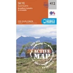
The best price for the Skye - Cuillin Hills - Soay by Ordnance Survey (Sheet map/active map, folded, 2015) starts from £13.99, with listings currently reaching up to £15.29 across 2 verified retailers. Availability and pricing may vary depending on seller and condition.

We’ve identified 2 active listings available in New condition. This allows you to compare available options based on price, condition and seller.

Why compare prices on Compare A Price?

  • Compare prices from verified retailers in one place
  • View available listings across new, used and refurbished conditions
  • See transparent price differences to support informed buying decisions

Compare Prices
Across 3.8M+ Products

Search millions of products beyond Maps to compare prices instantly.

Compare Before You Buy

Compare Skye - Cuillin Hills - Soay by Ordnance Survey (Sheet map/active map, folded, 2015) prices, retailer options and product listings before buying online.

Comparing prices for Skye - Cuillin Hills - Soay by Ordnance Survey (Sheet map/active map, folded, 2015) can help shoppers spot differences between retailers, product listings and purchase options before checkout. Prices may vary depending on stock availability, seller pricing, delivery choices, product condition or marketplace listings.

Compare A Price helps bring Skye - Cuillin Hills - Soay by Ordnance Survey (Sheet map/active map, folded, 2015) listings into one place, making it easier to review prices across different UK stores and shopping platforms. Some listings may include new, used or refurbished products, while others may vary by model version, included accessories or seller conditions. Comparing carefully before buying can help shoppers make more informed decisions online.

The same product can appear at different prices across retailers for many reasons, including promotions, stock changes and marketplace competition. Checking multiple listings for Skye - Cuillin Hills - Soay by Ordnance Survey (Sheet map/active map, folded, 2015) helps shoppers compare available options without manually searching across numerous websites.

Why Prices Vary Between Retailers

Understand pricing differences and buying options for Skye - Cuillin Hills - Soay by Ordnance Survey (Sheet map/active map, folded, 2015) before choosing the deal that suits you best.

When comparing prices for Skye - Cuillin Hills - Soay by Ordnance Survey (Sheet map/active map, folded, 2015), it’s helpful to look beyond individual listings and understand how pricing can vary across the wider market. Differences in price may reflect factors such as product condition, retailer pricing strategies, stock availability or additional services like delivery and returns. By reviewing multiple offers together, shoppers can build a clearer picture of how Skye - Cuillin Hills - Soay by Ordnance Survey (Sheet map/active map, folded, 2015) is positioned at any given time. This approach supports more confident decision-making, helping you recognise fair value and avoid relying on a single price point when assessing available options.

Comparing prices with confidence also means understanding what matters most to you as a buyer. Some shoppers prioritise lower upfront cost, while others may value retailer reputation, warranty coverage or convenience. Price comparison allows you to weigh these considerations side by side rather than focusing solely on headline pricing.

(3.7)
EAN:9780319472668

Maps By Ordnance Survey

Available Conditions:

We may earn a commission for qualifying purchases through affiliate links. Affiliate Disclosure

Marketplace Listings

We may earn a commission for qualifying purchases through affiliate links. Affiliate Disclosure

Logo of Amazon

Amazon

Visit Site
Logo of eBay

eBay

Visit Site

Compare UK Stores Prices

Showing all 2 offers

We may earn a commission for qualifying purchases through affiliate links. Affiliate Disclosure

Logo of Hive Books

Hive Books

£13.99
View Deal
  • Access real-time availability from retailers and marketplaces
  • Looking to compare Ordnance Survey Maps prices in the UK? Browse current offers and explore live listings from multiple sellers to find a deal that suits your budget.

    Frequently Asked Questions

    What prices are shown for Skye - Cuillin Hills - Soay by Ordnance Survey (Sheet map/active map, folded, 2015) on this page?
    This page shows verified retailer offers for Skye - Cuillin Hills - Soay by Ordnance Survey (Sheet map/active map, folded, 2015). Verified retailer offers are the main price context on this page.
    What does "verified retailer offer" mean?
    Verified retailer offers are listings from retailers intended to match the product shown on this page. When available, they are treated as the main price context for Skye - Cuillin Hills - Soay by Ordnance Survey (Sheet map/active map, folded, 2015) on Compare A Price.
    What are "marketplace related listings" (Amazon/eBay)?
    Marketplace related listings come from marketplaces such as Amazon and eBay. When shown, they are not verified exact matches and may include accessories, bundles, variants, refurbished/used items, or different conditions.
    What's the lowest price shown for Skye - Cuillin Hills - Soay by Ordnance Survey (Sheet map/active map, folded, 2015) on this page?
    The lowest verified retailer price shown on this page for Skye - Cuillin Hills - Soay by Ordnance Survey (Sheet map/active map, folded, 2015) is £13.99. Click through to the retailer to confirm delivery costs, stock status, and final total.
    How many offers are shown for Skye - Cuillin Hills - Soay by Ordnance Survey (Sheet map/active map, folded, 2015)?
    This page shows 2 verified retailer listings across 2 retailers.
    Where do the marketplace listings come from?
    When marketplace related listings are shown, they can come from Amazon and/or eBay.
    Which price should I use as the main product price?
    Use verified retailer prices on this page as the main price context for Skye - Cuillin Hills - Soay by Ordnance Survey (Sheet map/active map, folded, 2015). Marketplace prices are shown separately as related listings and are not verified exact matches.
    Why can marketplace prices look much lower than retailer prices?
    When marketplace related listings appear, they may refer to accessories, bundles, older revisions, refurbished/used units, or different variants, so they are shown separately from verified retailer offers.
    Does the listed price include delivery and fees?
    Not always. Some sellers include delivery in the listed price, while others add fees at checkout. Click through from the listing on this page to confirm delivery costs, fees, and the final total.
    Is Skye - Cuillin Hills - Soay by Ordnance Survey (Sheet map/active map, folded, 2015) in stock?
    Listings can change. Click through from an offer shown on this page to confirm current stock and delivery times on the seller's site.
    How often is this page updated?
    We update listings using data provided by retailers and marketplaces, and update timing can vary by source. This page reflects the most recent listing data we've received for the offers currently shown here.
    Where can I browse alternatives to Skye - Cuillin Hills - Soay by Ordnance Survey (Sheet map/active map, folded, 2015)?
    Browse more items in Maps to compare similar alternatives by price and availability.
    Where can I buy Skye - Cuillin Hills - Soay by Ordnance Survey (Sheet map/active map, folded, 2015) in the UK?
    You can buy Skye - Cuillin Hills - Soay by Ordnance Survey (Sheet map/active map, folded, 2015) from the verified retailer offers shown on this page, starting from £13.99. Open an offer to check delivery, returns and final total on the retailer’s site.
    What’s the best price for Skye - Cuillin Hills - Soay by Ordnance Survey (Sheet map/active map, folded, 2015)?
    The lowest verified retailer price shown on this page for Skye - Cuillin Hills - Soay by Ordnance Survey (Sheet map/active map, folded, 2015) is £13.99. This reflects the verified retailer offers currently displayed here. Open the offer to confirm delivery costs, stock status and final total on the retailer’s site.

    EANs & GTINs

    1. 9780319472668

    Disclaimer: While we aim to keep product data accurate and up to date, EANs and GTINs are provided for informational purposes only. We recommend verifying product identifiers directly on the manufacturer's or retailer's website before purchasing.

    Compare Prices

    Explore Listings

    Shop Smarter

    Whether searching for everyday essentials, technology products, appliances, gaming accessories or lifestyle purchases, comparing prices before buying can help shoppers understand available options more clearly. Compare A Price supports product discovery by helping users review retailer listings, compare pricing differences and explore purchase choices for Skye - Cuillin Hills - Soay by Ordnance Survey (Sheet map/active map, folded, 2015) in one simpler shopping journey.

    Confident Comparison

    Compare prices for Skye - Cuillin Hills - Soay by Ordnance Survey (Sheet map/active map, folded, 2015) across sellers to understand value, availability and buying options clearly.

    Clear Market View

    See how Skye - Cuillin Hills - Soay by Ordnance Survey (Sheet map/active map, folded, 2015) prices vary across the market to assess fair value confidently.

    Smarter Decisions

    Use price comparison insights for Skye - Cuillin Hills - Soay by Ordnance Survey (Sheet map/active map, folded, 2015) to choose offers matching your budget and preferences.

    01
    New In Stock

    EAN: 09780319472668

    Skye - Cuillin Hills - Soay Sheet map, folded
    £13.99View Deal
    Logo of Love Reading

    Love Reading

    £15.29
    View Deal
    01
    New In Stock

    EAN: 09780319472668

    Skye - Cuillin Hills Books
    £15.29View Deal

    Related Ordnance Survey Maps Products

    Compare similar products related to Skye - Cuillin Hills - Soay by Ordnance Survey (Sheet map/active map, folded, 2015) to explore alternative options.

    Similar Choice

    Image of Yorkshire Dales South & Western by Ordnance Survey (Sheet map, folded, 2016)

    Yorkshire Dales South & Western by Ordnance Survey (Sheet map, folded, 2016)

    Starting From

    £11.19

    3 Stores

    Similar Choice

    Image of Yorkshire Dales Northern & Central by Ordnance Survey (Sheet map, folded, 2016)

    Yorkshire Dales Northern & Central by Ordnance Survey (Sheet map, folded, 2016)

    Starting From

    £11.19

    3 Stores

    Similar Choice

    Image of Yeovil and Sherbourne:129 by Ordnance Survey (Sheet map, folded, 2015)

    Yeovil and Sherbourne:129 by Ordnance Survey (Sheet map, folded, 2015)

    Starting From

    £13.55

    2 Stores

    Similar Choice

    Image of Woodbridge and Saxmundham by Ordnance Survey (Sheet map, folded, 2015)

    Woodbridge and Saxmundham by Ordnance Survey (Sheet map, folded, 2015)

    Starting From

    £11.19

    2 Stores

    Similar Choice

    Image of Wolverhampton and Dudley, Stourbridge and Kidderminster by Ordnance Survey (Sheet map, folded, 2015)

    Wolverhampton and Dudley, Stourbridge and Kidderminster by Ordnance Survey (Sheet map, folded, 2015)

    Starting From

    £11.65

    2 Stores

    Similar Choice

    Image of Withernsea and Spurn Head by Ordnance Survey (Sheet map, folded, 2015)

    Withernsea and Spurn Head by Ordnance Survey (Sheet map, folded, 2015)

    Starting From

    £13.75

    2 Stores

    Similar Choice

    Image of Winchester, New Alresford & East Meon by Ordnance Survey (Sheet map, folded, 2015)

    Winchester, New Alresford & East Meon by Ordnance Survey (Sheet map, folded, 2015)

    Starting From

    £13.55

    2 Stores

    Similar Choice

    Image of Whitby, Esk Dale & Robin Hood's Bay by Ordnance Survey (Sheet map, folded, 2016)

    Whitby, Esk Dale & Robin Hood's Bay by Ordnance Survey (Sheet map, folded, 2016)

    Starting From

    £11.19

    2 Stores

    Similar Choice

    Image of Weston-Super-Mare and Bleadon Hill by Ordnance Survey (Sheet map, folded, 2015)

    Weston-Super-Mare and Bleadon Hill by Ordnance Survey (Sheet map, folded, 2015)

    Starting From

    £13.55

    2 Stores

    Similar Choice

    Image of West Lewis/Taobh Siar Leodhais by Ordnance Survey (Sheet map, folded, 2015)

    West Lewis/Taobh Siar Leodhais by Ordnance Survey (Sheet map, folded, 2015)

    Starting From

    £13.55

    2 Stores

    Similar Choice

    Image of Warminster and Trowbridge by Ordnance Survey (Sheet map/active map, folded, 2015)

    Warminster and Trowbridge by Ordnance Survey (Sheet map/active map, folded, 2015)

    Starting From

    £13.55

    2 Stores

    Similar Choice

    Image of Warminster and Trowbridge by Ordnance Survey (Sheet map, folded, 2015)

    Warminster and Trowbridge by Ordnance Survey (Sheet map, folded, 2015)

    Starting From

    £11.19

    2 Stores

    Similar Choice

    Image of Wales & West Midlands by Ordnance Survey (Sheet map, folded, 2016)

    Wales & West Midlands by Ordnance Survey (Sheet map, folded, 2016)

    Listing From

    £37.50

    2 Marketplaces

    Similar Choice

    Image of Vale of Glamorgan, Rhondda & Porthcawl by Ordnance Survey (Sheet map, folded, 2016)

    Vale of Glamorgan, Rhondda & Porthcawl by Ordnance Survey (Sheet map, folded, 2016)

    Starting From

    £11.19

    2 Stores

    Similar Choice

    Image of Upper Clyde Valley, Biggar & Lanark by Ordnance Survey (Sheet map, folded, 2016)

    Upper Clyde Valley, Biggar & Lanark by Ordnance Survey (Sheet map, folded, 2016)

    Starting From

    £11.19

    2 Stores

    Similar Choice

    Image of Truro & Falmouth, Roseland Peninsula by Ordnance Survey (Sheet map, folded, 2016)

    Truro & Falmouth, Roseland Peninsula by Ordnance Survey (Sheet map, folded, 2016)

    AmazoneBay

    2 Marketplaces

    Similar Choice

    Image of Torquay & Dawlish, Newton Abbot by Ordnance Survey (Sheet map, folded, 2015)

    Torquay & Dawlish, Newton Abbot by Ordnance Survey (Sheet map, folded, 2015)

    Starting From

    £11.19

    2 Stores

    Similar Choice

    Image of Thurso and John O'Groats by Ordnance Survey (Sheet map, folded, 2015)

    Thurso and John O'Groats by Ordnance Survey (Sheet map, folded, 2015)

    Starting From

    £11.19

    2 Stores

    Similar Choice

    Image of Thurso & Wick, John O'Groats by Ordnance Survey (Sheet map, folded, 2016)

    Thurso & Wick, John O'Groats by Ordnance Survey (Sheet map, folded, 2016)

    AmazoneBay

    2 Marketplaces

    Similar Choice

    Image of Thurso & Dunbeath by Ordnance Survey (Sheet map, folded, 2016)

    Thurso & Dunbeath by Ordnance Survey (Sheet map, folded, 2016)

    Starting From

    £11.19

    3 Stores

    Similar Choice

    Image of Thornbury, Dursley and Yate by Ordnance Survey (Sheet map, folded, 2015)

    Thornbury, Dursley and Yate by Ordnance Survey (Sheet map, folded, 2015)

    Starting From

    £11.65

    2 Stores

    Similar Choice

    Image of Thetford Forest in the Brecks by Ordnance Survey (Sheet map, folded, 2015)

    Thetford Forest in the Brecks by Ordnance Survey (Sheet map, folded, 2015)

    Starting From

    £13.75

    2 Stores

    Similar Choice

    Image of Thetford & Diss, Breckland & Wymondham by Ordnance Survey (Sheet map, folded, 2016)

    Thetford & Diss, Breckland & Wymondham by Ordnance Survey (Sheet map, folded, 2016)

    Starting From

    £13.55

    2 Stores

    Similar Choice

    Image of The Cheviot Hills, Jedburgh & Wooler by Ordnance Survey (Sheet map, folded, 2015)

    The Cheviot Hills, Jedburgh & Wooler by Ordnance Survey (Sheet map, folded, 2015)

    Starting From

    £13.55

    2 Stores

    Similar Choice

    Image of Thames Estuary, Rochester & Southend-on-Sea by Ordnance Survey (Sheet map, folded, 2016)

    Thames Estuary, Rochester & Southend-on-Sea by Ordnance Survey (Sheet map, folded, 2016)

    Starting From

    £13.55

    2 Stores

    Similar Choice

    Image of Tenby & Pembroke by Ordnance Survey (Sheet map, folded, 2016)

    Tenby & Pembroke by Ordnance Survey (Sheet map, folded, 2016)

    Starting From

    £13.55

    2 Stores

    Similar Choice

    Image of Telford, Ironbridge and the Wrekin by Ordnance Survey (Sheet map, folded, 2015)

    Telford, Ironbridge and the Wrekin by Ordnance Survey (Sheet map, folded, 2015)

    Starting From

    £11.65

    2 Stores

    Similar Choice

    Image of Swansea, Neath and Port Talbot by Ordnance Survey (Sheet map, folded, 2015)

    Swansea, Neath and Port Talbot by Ordnance Survey (Sheet map, folded, 2015)

    Starting From

    £11.19

    2 Stores

    Similar Choice

    Image of Stroud, Tetbury and Malmesbury by Ordnance Survey (Sheet map, folded, 2015)

    Stroud, Tetbury and Malmesbury by Ordnance Survey (Sheet map, folded, 2015)

    Starting From

    £11.19

    2 Stores

    Similar Choice

    Image of Strathnaver, Bettyhill & Tongue by Ordnance Survey (Sheet map, folded, 2016)

    Strathnaver, Bettyhill & Tongue by Ordnance Survey (Sheet map, folded, 2016)

    Starting From

    £11.19

    3 Stores

    Similar Choice

    Image of Strathdon & Alford by Ordnance Survey (Sheet map, folded, 2016)

    Strathdon & Alford by Ordnance Survey (Sheet map, folded, 2016)

    Starting From

    £11.85

    3 Stores

    Similar Choice

    Image of Strath Halladale and Strathy Point by Ordnance Survey (Sheet map, folded, 2015)

    Strath Halladale and Strathy Point by Ordnance Survey (Sheet map, folded, 2015)

    Starting From

    £11.19

    2 Stores

    Similar Choice

    Image of Stratford-Upon-Avon and Evesham by Ordnance Survey (Sheet map, folded, 2015)

    Stratford-Upon-Avon and Evesham by Ordnance Survey (Sheet map, folded, 2015)

    Starting From

    £11.19

    2 Stores

    Similar Choice

    Image of Stranraer & Glenluce by Ordnance Survey (Sheet map, folded, 2016)

    Stranraer & Glenluce by Ordnance Survey (Sheet map, folded, 2016)

    Starting From

    £11.19

    2 Stores

    Similar Choice

    Image of Stoke-On-Trent and Newcastle Under Lyme by Ordnance Survey (Sheet map, folded, 2015)

    Stoke-On-Trent and Newcastle Under Lyme by Ordnance Survey (Sheet map, folded, 2015)

    Starting From

    £11.19

    3 Stores

    Similar Choice

    Image of Stirling and Ochil Hills West by Ordnance Survey (Sheet map, folded, 2015)

    Stirling and Ochil Hills West by Ordnance Survey (Sheet map, folded, 2015)

    Starting From

    £13.55

    2 Stores

    Similar Choice

    Image of Stirling & the Trossachs by Ordnance Survey (Sheet map, folded, 2016)

    Stirling & the Trossachs by Ordnance Survey (Sheet map, folded, 2016)

    Starting From

    £13.55

    2 Stores

    Similar Choice

    Image of Stafford & Telford, Ironbridge by Ordnance Survey (Sheet map, folded, 2016)

    Stafford & Telford, Ironbridge by Ordnance Survey (Sheet map, folded, 2016)

    Starting From

    £11.19

    2 Stores

    Similar Choice

    Image of St.Austell, Liskeard, Fowey, Looe and Lostwithiel by Ordnance Survey (Sheet map, folded, 2015)

    St.Austell, Liskeard, Fowey, Looe and Lostwithiel by Ordnance Survey (Sheet map, folded, 2015)

    Starting From

    £11.19

    2 Stores

    Similar Choice

    Image of St Davids & Haverfordwest:157 by Ordnance Survey (Sheet map, folded, 2016)

    St Davids & Haverfordwest:157 by Ordnance Survey (Sheet map, folded, 2016)

    Starting From

    £11.19

    3 Stores

    Compare Popular Maps

    Discover popular Maps and compare prices from trusted sellers to find the right deal.

    Image of North Downs Way (Trailblazer British Walking Guides) : Practical walking guide to North Downs Way with 80 Large-Scale Walking Maps & Guides to 45 Town

    North Downs Way (Trailblazer British Walking Guides) : Practical walking guide to North Downs Way with 80 Large-Scale Walking Maps & Guides to 45 Town

    AmazoneBay
    Compare

    Popular Maps Brands

    Compare Maps products from well known brands available across retailers.

    Books Logo
    Maps Logo
    Ordnance Survey Logo
    Michelin Logo

    Popular Ordnance Survey Categories

    Compare popular Ordnance Survey categories to find the best products and deals

    Maps Logo
    Maps
    Lamps Logo
    Lamps
    Bedsheets Logo
    Bedsheets

    Explore More Ordnance Survey Products

    Browse and compare other popular Ordnance Survey products to find the right option for you.

    Image of Yorkshire Dales South & Western by Ordnance Survey (Sheet map, folded, 2016)

    Yorkshire Dales South & Western by Ordnance Survey (Sheet map, folded, 2016)

    Starting From

    £11.19

    Compare
    Compare
    Image of Yorkshire Dales South & Western by Ordnance Survey (Sheet map, folded, 2016)

    Yorkshire Dales South & Western by Ordnance Survey (Sheet map, folded, 2016)

    Starting From

    £11.19

    Compare
    Image of Yorkshire Dales Northern & Central by Ordnance Survey (Sheet map, folded, 2016)

    Yorkshire Dales Northern & Central by Ordnance Survey (Sheet map, folded, 2016)

    Starting From

    £11.19

    Compare
    Image of Yeovil and Sherbourne:129 by Ordnance Survey (Sheet map, folded, 2015)

    Yeovil and Sherbourne:129 by Ordnance Survey (Sheet map, folded, 2015)

    Starting From

    £13.55

    Compare
    Image of Yeovil and Sherbourne by Ordnance Survey (Sheet map, folded, 2015)

    Yeovil and Sherbourne by Ordnance Survey (Sheet map, folded, 2015)

    Starting From

    £11.19

    Compare
    Image of Writing London Sheet map, folded 2015

    Writing London Sheet map, folded 2015

    AmazoneBay
    Compare
    Image of World political laminated 2018 Sheet map, rolled

    World political laminated 2018 Sheet map, rolled

    Starting From

    £28.55

    Compare
    Image of World Map

    World Map

    Listing From

    £6.64

    Compare
    Image of Woodbridge and Saxmundham by Ordnance Survey (Sheet map, folded, 2015)

    Woodbridge and Saxmundham by Ordnance Survey (Sheet map, folded, 2015)

    Starting From

    £11.19

    Compare
    Image of Wolverhampton and Dudley, Stourbridge and Kidderminster by Ordnance Survey (Sheet map, folded, 2015)

    Wolverhampton and Dudley, Stourbridge and Kidderminster by Ordnance Survey (Sheet map, folded, 2015)

    Starting From

    £11.65

    Compare
    Image of Withernsea and Spurn Head by Ordnance Survey (Sheet map, folded, 2015)

    Withernsea and Spurn Head by Ordnance Survey (Sheet map, folded, 2015)

    Starting From

    £13.75

    Compare
    Image of Winchester, New Alresford & East Meon by Ordnance Survey (Sheet map, folded, 2015)

    Winchester, New Alresford & East Meon by Ordnance Survey (Sheet map, folded, 2015)

    Starting From

    £13.55

    Compare
    Image of Wild London Sheet map, folded 2016

    Wild London Sheet map, folded 2016

    Starting From

    £3.60

    Compare
    Image of Whitby, Esk Dale & Robin Hood's Bay by Ordnance Survey (Sheet map, folded, 2016)

    Whitby, Esk Dale & Robin Hood's Bay by Ordnance Survey (Sheet map, folded, 2016)

    Starting From

    £11.19

    Compare
    Image of Weston-Super-Mare, Bridgwater & Wells by Ordnance Survey (Sheet map, folded, 2016)

    Weston-Super-Mare, Bridgwater & Wells by Ordnance Survey (Sheet map, folded, 2016)

    Starting From

    £11.19

    Compare
    Image of Weston-Super-Mare and Bleadon Hill by Ordnance Survey (Sheet map, folded, 2015)

    Weston-Super-Mare and Bleadon Hill by Ordnance Survey (Sheet map, folded, 2015)

    Starting From

    £13.55

    Compare
    Image of West Lewis/Taobh Siar Leodhais by Ordnance Survey (Sheet map, folded, 2015)

    West Lewis/Taobh Siar Leodhais by Ordnance Survey (Sheet map, folded, 2015)

    Starting From

    £13.55

    Compare
    Image of West Highland Way XT40 2008 Sheet map, folded

    West Highland Way XT40 2008 Sheet map, folded

    Starting From

    £13.95

    Compare
    Image of West Highland Way (Trailblazer British Walking Guides) : 53 large-scale maps & guides to 26 towns and villages; Planning, Places to Stay, Places to Ea

    West Highland Way (Trailblazer British Walking Guides) : 53 large-scale maps & guides to 26 towns and villages; Planning, Places to Stay, Places to Ea

    AmazoneBay
    Compare
    Image of Wensleydale & Upper Wharfedale Sheet map, folded 2016

    Wensleydale & Upper Wharfedale Sheet map, folded 2016

    Starting From

    £13.55

    Compare
    Image of Washington DC PopOut Map Sheet map, folded 2018

    Washington DC PopOut Map Sheet map, folded 2018

    AmazoneBay
    Compare
    Image of Warminster and Trowbridge by Ordnance Survey (Sheet map/active map, folded, 2015)

    Warminster and Trowbridge by Ordnance Survey (Sheet map/active map, folded, 2015)

    Starting From

    £13.55

    Compare
    Image of Warminster and Trowbridge by Ordnance Survey (Sheet map, folded, 2015)

    Warminster and Trowbridge by Ordnance Survey (Sheet map, folded, 2015)

    Starting From

    £11.19

    Compare
    Image of Wales & West Midlands by Ordnance Survey (Sheet map, folded, 2016)

    Wales & West Midlands by Ordnance Survey (Sheet map, folded, 2016)

    Listing From

    £37.50

    Compare
    Image of Venice - Michelin City Map 9206 Laminated City Plan Sheet map 2016

    Venice - Michelin City Map 9206 Laminated City Plan Sheet map 2016

    AmazoneBay
    Compare
    Image of Veneto / Friuli Venice / Giulia 4 Sheet map, folded 2016

    Veneto / Friuli Venice / Giulia 4 Sheet map, folded 2016

    AmazoneBay
    Compare
    Image of Vale of Glamorgan, Rhondda & Porthcawl by Ordnance Survey (Sheet map, folded, 2016)

    Vale of Glamorgan, Rhondda & Porthcawl by Ordnance Survey (Sheet map, folded, 2016)

    Starting From

    £11.19

    Compare
    Image of USA West Marco Polo Map by Marco Polo (Sheet map, folded, 2011)

    USA West Marco Polo Map by Marco Polo (Sheet map, folded, 2011)

    AmazoneBay
    Compare
    Image of USA - Michelin National Map 761 Map Sheet map 2012

    USA - Michelin National Map 761 Map Sheet map 2012

    AmazoneBay
    Compare
    Image of Upper Clyde Valley, Biggar & Lanark by Ordnance Survey (Sheet map, folded, 2016)

    Upper Clyde Valley, Biggar & Lanark by Ordnance Survey (Sheet map, folded, 2016)

    Starting From

    £11.19

    Compare
    Image of Umbria and the Marches Marco Polo Map Sheet map, folded 2012

    Umbria and the Marches Marco Polo Map Sheet map, folded 2012

    AmazoneBay
    Compare
    Image of Tuscany Marco Polo Map Sheet map, folded 2011

    Tuscany Marco Polo Map Sheet map, folded 2011

    AmazoneBay
    Compare
    Image of Tuscany Marco Polo Holiday Map by Marco Polo (Sheet map, folded, 2013)

    Tuscany Marco Polo Holiday Map by Marco Polo (Sheet map, folded, 2013)

    AmazoneBay
    Compare
    Image of Truro & Falmouth, Roseland Peninsula by Ordnance Survey (Sheet map, folded, 2016)

    Truro & Falmouth, Roseland Peninsula by Ordnance Survey (Sheet map, folded, 2016)

    AmazoneBay
    Compare
    Image of Trailblazer Pennine Way

    Trailblazer Pennine Way

    Starting From

    £11.65

    Compare
    Image of Trailblazer Dales Way

    Trailblazer Dales Way

    Starting From

    £10.23

    Compare
    Origin Murals Logo
    Generic Logo
    NGK Logo
    Jigsaw Puzzle Logo
    Cambridge Logo
    Celestron Logo
    Collins Debden Logo
    Costa Logo
    Nikon Logo
    Dorling Kindersley Logo
    Dublin Logo
    Sports Merchandise Logo
    DC Comics Logo
    Oxford Logo
    Play & Go Logo
    Board Games Logo
    Books Logo
    Books
    Image of Yorkshire Dales Northern & Central by Ordnance Survey (Sheet map, folded, 2016)

    Yorkshire Dales Northern & Central by Ordnance Survey (Sheet map, folded, 2016)

    Starting From

    £11.19

    Compare
    Compare
    Image of Yeovil and Sherbourne:129 by Ordnance Survey (Sheet map, folded, 2015)

    Yeovil and Sherbourne:129 by Ordnance Survey (Sheet map, folded, 2015)

    Starting From

    £13.55

    Compare
    Compare
    Image of Woodbridge and Saxmundham by Ordnance Survey (Sheet map, folded, 2015)

    Woodbridge and Saxmundham by Ordnance Survey (Sheet map, folded, 2015)

    Starting From

    £11.19

    Compare
    Compare
    Image of Wolverhampton and Dudley, Stourbridge and Kidderminster by Ordnance Survey (Sheet map, folded, 2015)

    Wolverhampton and Dudley, Stourbridge and Kidderminster by Ordnance Survey (Sheet map, folded, 2015)

    Starting From

    £11.65

    Compare
    Compare
    Image of Withernsea and Spurn Head by Ordnance Survey (Sheet map, folded, 2015)

    Withernsea and Spurn Head by Ordnance Survey (Sheet map, folded, 2015)

    Starting From

    £13.75

    Compare
    Compare
    Image of Winchester, New Alresford & East Meon by Ordnance Survey (Sheet map, folded, 2015)

    Winchester, New Alresford & East Meon by Ordnance Survey (Sheet map, folded, 2015)

    Starting From

    £13.55

    Compare
    Compare
    Image of Whitby, Esk Dale & Robin Hood's Bay by Ordnance Survey (Sheet map, folded, 2016)

    Whitby, Esk Dale & Robin Hood's Bay by Ordnance Survey (Sheet map, folded, 2016)

    Starting From

    £11.19

    Compare
    Compare
    Image of Weston-Super-Mare and Bleadon Hill by Ordnance Survey (Sheet map, folded, 2015)

    Weston-Super-Mare and Bleadon Hill by Ordnance Survey (Sheet map, folded, 2015)

    Starting From

    £13.55

    Compare
    Compare
    Image of West Lewis/Taobh Siar Leodhais by Ordnance Survey (Sheet map, folded, 2015)

    West Lewis/Taobh Siar Leodhais by Ordnance Survey (Sheet map, folded, 2015)

    Starting From

    £13.55

    Compare
    Compare
    Image of Warminster and Trowbridge by Ordnance Survey (Sheet map/active map, folded, 2015)

    Warminster and Trowbridge by Ordnance Survey (Sheet map/active map, folded, 2015)

    Starting From

    £13.55

    Compare
    Compare
    Image of Warminster and Trowbridge by Ordnance Survey (Sheet map, folded, 2015)

    Warminster and Trowbridge by Ordnance Survey (Sheet map, folded, 2015)

    Starting From

    £11.19

    Compare
    Compare
    Image of Wales & West Midlands by Ordnance Survey (Sheet map, folded, 2016)

    Wales & West Midlands by Ordnance Survey (Sheet map, folded, 2016)

    Listing From

    £37.50

    Compare
    Compare
    Image of Vale of Glamorgan, Rhondda & Porthcawl by Ordnance Survey (Sheet map, folded, 2016)

    Vale of Glamorgan, Rhondda & Porthcawl by Ordnance Survey (Sheet map, folded, 2016)

    Starting From

    £11.19

    Compare
    Compare
    Image of Upper Clyde Valley, Biggar & Lanark by Ordnance Survey (Sheet map, folded, 2016)

    Upper Clyde Valley, Biggar & Lanark by Ordnance Survey (Sheet map, folded, 2016)

    Starting From

    £11.19

    Compare
    Compare
    Image of Truro & Falmouth, Roseland Peninsula by Ordnance Survey (Sheet map, folded, 2016)

    Truro & Falmouth, Roseland Peninsula by Ordnance Survey (Sheet map, folded, 2016)

    AmazoneBay
    Compare
    Compare
    Image of Torquay & Dawlish, Newton Abbot by Ordnance Survey (Sheet map, folded, 2015)

    Torquay & Dawlish, Newton Abbot by Ordnance Survey (Sheet map, folded, 2015)

    Starting From

    £11.19

    Compare
    Compare
    Image of Thurso and John O'Groats by Ordnance Survey (Sheet map, folded, 2015)

    Thurso and John O'Groats by Ordnance Survey (Sheet map, folded, 2015)

    Starting From

    £11.19

    Compare
    Compare
    Image of Thurso & Wick, John O'Groats by Ordnance Survey (Sheet map, folded, 2016)

    Thurso & Wick, John O'Groats by Ordnance Survey (Sheet map, folded, 2016)

    AmazoneBay
    Compare
    Compare
    Image of Thurso & Dunbeath by Ordnance Survey (Sheet map, folded, 2016)

    Thurso & Dunbeath by Ordnance Survey (Sheet map, folded, 2016)

    Starting From

    £11.19

    Compare
    Compare
    Image of Thornbury, Dursley and Yate by Ordnance Survey (Sheet map, folded, 2015)

    Thornbury, Dursley and Yate by Ordnance Survey (Sheet map, folded, 2015)

    Starting From

    £11.65

    Compare
    Compare
    Image of Thetford Forest in the Brecks by Ordnance Survey (Sheet map, folded, 2015)

    Thetford Forest in the Brecks by Ordnance Survey (Sheet map, folded, 2015)

    Starting From

    £13.75

    Compare
    Compare
    Image of Thetford & Diss, Breckland & Wymondham by Ordnance Survey (Sheet map, folded, 2016)

    Thetford & Diss, Breckland & Wymondham by Ordnance Survey (Sheet map, folded, 2016)

    Starting From

    £13.55

    Compare
    Compare
    Image of The Cheviot Hills, Jedburgh & Wooler by Ordnance Survey (Sheet map, folded, 2015)

    The Cheviot Hills, Jedburgh & Wooler by Ordnance Survey (Sheet map, folded, 2015)

    Starting From

    £13.55

    Compare
    Compare
    Image of Thames Estuary, Rochester & Southend-on-Sea by Ordnance Survey (Sheet map, folded, 2016)

    Thames Estuary, Rochester & Southend-on-Sea by Ordnance Survey (Sheet map, folded, 2016)

    Starting From

    £13.55

    Compare
    Compare
    Image of Tenby & Pembroke by Ordnance Survey (Sheet map, folded, 2016)

    Tenby & Pembroke by Ordnance Survey (Sheet map, folded, 2016)

    Starting From

    £13.55

    Compare
    Compare
    Image of Telford, Ironbridge and the Wrekin by Ordnance Survey (Sheet map, folded, 2015)

    Telford, Ironbridge and the Wrekin by Ordnance Survey (Sheet map, folded, 2015)

    Starting From

    £11.65

    Compare
    Compare
    Image of Swansea, Neath and Port Talbot by Ordnance Survey (Sheet map, folded, 2015)

    Swansea, Neath and Port Talbot by Ordnance Survey (Sheet map, folded, 2015)

    Starting From

    £11.19

    Compare
    Compare
    Image of Stroud, Tetbury and Malmesbury by Ordnance Survey (Sheet map, folded, 2015)

    Stroud, Tetbury and Malmesbury by Ordnance Survey (Sheet map, folded, 2015)

    Starting From

    £11.19

    Compare
    Compare
    Image of Strathnaver, Bettyhill & Tongue by Ordnance Survey (Sheet map, folded, 2016)

    Strathnaver, Bettyhill & Tongue by Ordnance Survey (Sheet map, folded, 2016)

    Starting From

    £11.19

    Compare
    Compare
    Image of Strathdon & Alford by Ordnance Survey (Sheet map, folded, 2016)

    Strathdon & Alford by Ordnance Survey (Sheet map, folded, 2016)

    Starting From

    £11.85

    Compare
    Compare
    Image of Strath Halladale and Strathy Point by Ordnance Survey (Sheet map, folded, 2015)

    Strath Halladale and Strathy Point by Ordnance Survey (Sheet map, folded, 2015)

    Starting From

    £11.19

    Compare
    Compare
    Image of Stratford-Upon-Avon and Evesham by Ordnance Survey (Sheet map, folded, 2015)

    Stratford-Upon-Avon and Evesham by Ordnance Survey (Sheet map, folded, 2015)

    Starting From

    £11.19

    Compare
    Compare
    Image of Stranraer & Glenluce by Ordnance Survey (Sheet map, folded, 2016)

    Stranraer & Glenluce by Ordnance Survey (Sheet map, folded, 2016)

    Starting From

    £11.19

    Compare
    Compare
    Image of Stoke-On-Trent and Newcastle Under Lyme by Ordnance Survey (Sheet map, folded, 2015)

    Stoke-On-Trent and Newcastle Under Lyme by Ordnance Survey (Sheet map, folded, 2015)

    Starting From

    £11.19

    Compare
    Compare
    Image of Stirling and Ochil Hills West by Ordnance Survey (Sheet map, folded, 2015)

    Stirling and Ochil Hills West by Ordnance Survey (Sheet map, folded, 2015)

    Starting From

    £13.55

    Compare
    Compare

    You May Also Like

    Discover more product options & choices on Compare A Price

    Image of Skye - Dunvegan

    Skye - Dunvegan

    Starting From

    £13.55

    Compare
    Image of Skye - Sleat by Ordnance Survey (Sheet map, folded, 2015)

    Skye - Sleat by Ordnance Survey (Sheet map, folded, 2015)

    Starting From

    £13.99

    Compare
    Image of Skye 360 by Andrew Dempster Paperback

    Skye 360 by Andrew Dempster Paperback

    Starting From

    £7.42

    Compare
    Image of Skye 500 Treetops Tent

    Skye 500 Treetops Tent

    AmazoneBay
    Compare
    Image of Skye and the North West Highlands Walks by Crimson Publishing Book

    Skye and the North West Highlands Walks by Crimson Publishing Book

    Starting From

    £2.99

    Compare
    Image of Skye by James Hunter and Cailean Maclean Book

    Skye by James Hunter and Cailean Maclean Book

    AmazoneBay
    Compare
    Image of Skye by Otta Swire Paperback

    Skye by Otta Swire Paperback

    AmazoneBay
    Compare
    Image of Skye by Ralph Storer Book

    Skye by Ralph Storer Book

    AmazoneBay
    Compare
    Image of skye falling a novel

    skye falling a novel

    AmazoneBay
    Compare
    Image of Skye High Paperback

    Skye High Paperback

    AmazoneBay
    Compare
    Image of Skye Low-Top Suede Trainers

    Skye Low-Top Suede Trainers

    AmazoneBay
    Compare
    Image of Skye Reversible Duvet Set

    Skye Reversible Duvet Set

    AmazoneBay
    Compare
    Image of Skye scrambles by D. Noel Williams

    Skye scrambles by D. Noel Williams

    AmazoneBay
    Compare
    Image of Skye The Cuillin Superwalker XT25 Map

    Skye The Cuillin Superwalker XT25 Map

    Starting From

    £14.05

    Compare
    Image of Skye The Island and Its Legends Paperback / softback 2018

    Skye The Island and Its Legends Paperback / softback 2018

    Starting From

    £8.72

    Compare
    Image of Skye the Puffling : A Baby Puffins Adventure

    Skye the Puffling : A Baby Puffins Adventure

    Starting From

    £2.99

    Compare
    Image of Skye the Puffling : A Wee Puffin Board Book

    Skye the Puffling : A Wee Puffin Board Book

    Starting From

    £5.67

    Compare
    Image of Skye Trail Sheet map, folded 2012

    Skye Trail Sheet map, folded 2012

    Starting From

    £13.95

    Compare
    Image of Skyfall (Includes HD UltraViolet Copy)

    Skyfall (Includes HD UltraViolet Copy)

    Starting From

    £7.87

    Compare
    Image of Skyfall - DVD

    Skyfall - DVD

    Starting From

    £1.99

    Compare
    Image of Skyfall by Thomas H Block Book

    Skyfall by Thomas H Block Book

    AmazoneBay
    Compare
    Image of Skyfall CD Album

    Skyfall CD Album

    Starting From

    £9.88

    Compare
    Image of Skyfall Vinyl Album

    Skyfall Vinyl Album

    AmazoneBay
    Compare
    Image of Skyfarer by Joseph Brassey

    Skyfarer by Joseph Brassey

    AmazoneBay
    Compare
    Image of Skyfaring by Mark Vanhoenacker Hardback

    Skyfaring by Mark Vanhoenacker Hardback

    AmazoneBay
    Compare
    Image of Skyfaring by Mark Vanhoenacker Paperback

    Skyfaring by Mark Vanhoenacker Paperback

    Starting From

    £11.09

    Compare
    Image of Skyfire - DVD - Used

    Skyfire - DVD - Used

    Starting From

    £1.99

    Compare
    Image of Skyfire [Bluray]

    Skyfire [Bluray]

    Starting From

    £12.58

    Compare
    Image of Skyforest - Harmony CD

    Skyforest - Harmony CD

    AmazoneBay
    Compare
    Image of Skyforest - Unity CD

    Skyforest - Unity CD

    Starting From

    £12.69

    Compare